


Our#: OM0052, ISBN: 0-929140-05-2, Scale: 1:10,000. Paper (not waterproof).
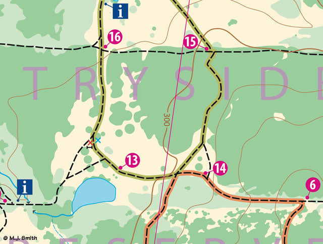
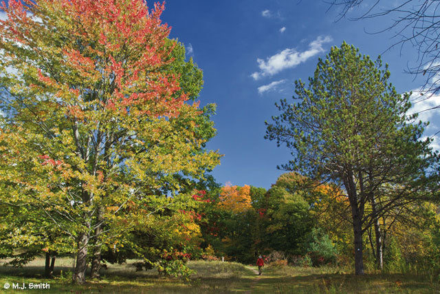
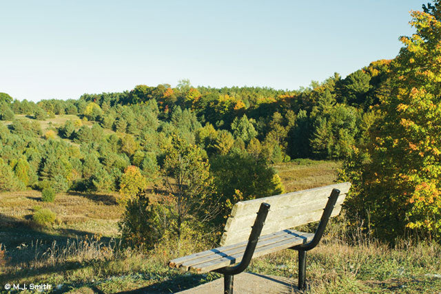
The Uxbridge Countryside Preserve is a superb mixed forest and meadow hiking area of rolling hills right on the edge of Town. It's perfect for a pleasant day-hike, bike, cross-country ski or snowshoe excursion with easy access and lots of services nearby. Trails are wide cut grass in the meadows and former farm roads in some of the forest, but there are also narrower dirt trails for the more adventurous, and even a great lookout hill for viewing fall colours off onto the distance.
Our guide combines a detailed, large-scale topographic map on one side, with some background on how the Preserve came to be, descriptions of 4 wildlife trail loops, points of interest, trail etiquette, safety tips and more useful information on the other side.
North Durham Nature, an organization dedicated to studying and promoting wildlife-related events, was helpful in defining the nature-focused loops marked on the map and in the terrain with posts and iconic route markers. This map has been adopted by the Township of Uxbridge as their official guide to the area.
–––––
For an excellent planning tool for the entire Uxbridge South area, including the Town of Uxbridge, the Countryside Preserve, we recommend purchasing a copy of the Uxbridge South Recreational Trails - Overview Map.
And for more detail in a waterproof format there are 3 topographic maps of the trail-rich area just south of the town of Uxbridge - the East "strip" includes Durham Forest Main Tract, Skyloft and Dagmar area, the Central "strip" includes the Walker Woods and Glen Major tracts, while the West “strip” includes the North Walker Woods, Wilder and Brock tracts.