• Welcome to our site • FREE SHIPPING in Canada for 2-3+ maps under total package weight of 500 grams • IMPORTANT NEWS: As you may be aware, the United States under U.S. Executive Order 14324, has suspended its duty-free de minimis (“disregard of trivial matters”) threshold of US$800 for all countries, including Canada. This order means that, starting August 29, 2025, all shipments entering the U.S. by post, courier, freight provider, or any commercial channel will be subject to an ad valorem (“according to value”) duty that must be prepaid before crossing the border. This duty will be equal to the effective tariff rate applicable to the product's country of origin (Canada in our case) under the International Emergency Economic Powers Act (IEEPA), a newly enacted old U.S. federal law. For Canada, the recently-assigned IEEPA rate is 35% for most goods. Unfortunately due to the onerous duties, declarations and paperwork involved required by this Executive order we will no longer be offering our products to either individual and business customers (only) in the United States. President Trump has repeatedly claimed that the Canada has “nothing” the USA needs. However, if you still wish to visit Canada for outdoor activities involving wilderness areas covered by our Adventure Map® series, we encourage you to seek out and purchase from a Canadian retailer after you cross the border. There is a list of such outlets on our website’s Where to Buy page. Call them in advance to ensure a copy is held for you to pick-up. And feel free to contact us if you have questions about the areas, maps or procedures • Best wishes •

Killarney Provincial Park Planning Map (OM0110-waterproof)

Killarney Provincial Park Planning Map (OM0110-waterproof)

Regular price
$18.95
Sale price
$18.95
Regular price
Sold out
Unit price
per 
Shipping calculated at checkout.

Our#: OM0110, ISBN: 0-978-2536-6-0, Waterproof. New version!

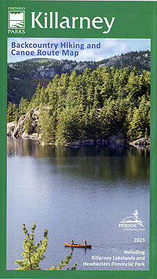
This waterproof, large format, medium-scale (1:55,000) topographic map of the entirety of Killarney Provincial Park, is perfect for planning your trip, and guiding you on the ground, or waters of this northeastern Ontario Park on the north shore of Georgian Bay. It provides good land and water details, as well as the essentials for hiking, backpacking and paddling adventures - all access points, campsites, portages, short and long-distance backpacking trails and other points of interest. This official Ontario Parks map and guide is the ideal reference for anyone visiting the Park. 

If you are interested in more detail for the southern edge of the Park and especially the fabulous Philip Edward Island collection of hundreds of paddlers paradise islands in Georgian Bay just south of the Park, then consider our larger-scale (1:30,000) topographic map and guide Philip Edward Island & Area Adventure Map® (AM0362). It includes George Lake campground in the Park but also all of Philip Edward Island, the Town of Killarney in the west all the way past Beaverstone Bay to Point Grondine in the east and the hundreds of islands out to the Foxes in the Bay.