• Welcome to our site • FREE SHIPPING in Canada for 2-3+ maps under total package weight of 500 grams • IMPORTANT NEWS: As you may be aware, the United States under U.S. Executive Order 14324, has suspended its duty-free de minimis (“disregard of trivial matters”) threshold of US$800 for all countries, including Canada. This order APPARENTLY means that, starting August 29, 2025, all shipments entering the U.S. by post, courier, freight provider, or any commercial channel will be subject to an ad valorem (“according to value”) duty that must be PREPAID BY THE SENDER before crossing the border. This duty will be equal to the effective tariff rate applicable to the product's country of origin (Canada in our case) under the International Emergency Economic Powers Act (IEEPA), a newly enacted old U.S. federal law. For Canada, the recently-assigned IEEPA rate is 35% for most goods. Unfortunately due to the onerous duties, declarations and paperwork required by this Executive order we will likely no longer be offering our products to individuals (possibly except by letter-mail) and business customers in (only) the United States. President Trump has repeatedly claimed that the Canada has “nothing” the USA needs. However, if you still wish to visit Canada for outdoor activities involving wilderness areas covered by our Adventure Map® series, we encourage you to seek out and purchase from a Canadian retailer after you cross the border. There is a list of such outlets on our website’s Where to Buy page. Call them in advance to ensure a copy is held for you to pick-up. And feel free to contact us if you have questions about the areas, maps or procedures • Best wishes •

Philip Edward Island & Area - Georgian Bay (AM0362)
Philip Edward Island Location Map
  • Load image into Gallery viewer, Philip Edward Island & Area - Georgian Bay (AM0362)
  • Load image into Gallery viewer, Philip Edward Island Location Map

Philip Edward Island & Area - Georgian Bay (AM0362)

Regular price
$13.95
Sale price
$13.95
Regular price
Sold out
Unit price
per 
Shipping calculated at checkout.

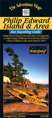
Our#: AM0362, ISBN: 0-929140-36-2, Scale: 1:30,000. Waterproof.

The north coast of Georgian Bay is considered to be among the most beautiful of wild kayaking and camping experiences in North America. Thousands of small, beautiful islands, some having fantastic shapes, fresh breezes, easy access, relatively low numbers of users and the lovely quartzite hills of Killarney Provincial Park in the background, will all make your Philip Edward Island trip a truly memorable event.

This map covers the area from Thomas Bay a few kilometres west of Chikanishing River and the west park boundary, all the way east to Point Grondine, and from the George Lake campground in Killarney Provincial Park all the way south to the remote Scarecrow and Green islands. That's all of PEI, Collins Inlet, Beaverstone Bay and the south edge of Killarney Provincial Park.

At 1:30,000 scale, our 18x32 inch map shows the area in extraordinary detail, and includes the usual features of essential interest to paddlers. You'll find access points, campsites, portages, shoals and shallows, points of interest, roads, hiking trails, detailed contours, and lots more, as well as text and colour photos describing the route, human and natural history, local attractions, safety considerations, and more.

This one is on waterproof plastic as usual, so paddlers can get it as wet as they like without it disintegrating! It can even double as a useful rain hat.

Another exceptional sea kayaking area on the Georgian Bay coast, a little further south near Parry Sound, is our Franklin, Mink & McCoy Islands guide. And further north on the shore of Lake Superior is the fabulous Pukaskwa National Park coast.