


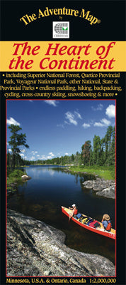
Our#: AM0419, ISBN: 0-929140-41-9, Scale: 1:2,000,000. Paper (not waterproof).
There is a place straddling the border between Ontario, Canada and Minnesota, United States that is becoming known as the Heart of The Continent. It is an area of extraordinary character, the largest protected wilderness area east of the Rocky Mountains, and provides a world-class opportunity for paddling, hiking, cross-country skiing, dog-sledding, cycling and other non-motorized outdoor activities.
The number of publicly managed protected areas here is unusual including the 3 million-acre Superior National Forest, which includes the USA's paddling mecca - Boundary Waters Canoe Area Wilderness. On the Canadian side of the border is Quetico Provincial Park, which offers a paddling-only extravaganza of countless lakes connected by short portages.
There is also Voyageurs National Park on the US side, with it 200 "boat-in" campsites, ranger-guided activities, hiking trails and in winter cross-country skiing, snowshoeing and ice fishing.
Or consider Sleeping Giant Provincial Park, that famous peninsula jutting into Lake Superior, with plenty of hiking trails, great vista over the lake and a fine campground to keep you busy.
Add in Grand Portage National Monument, La Verendrye Provincial Park Reserve, Fort William Historical Park, a whole slew of Minnesota State Parks, roaring Kakabeka Falls in the provincial park of the same name, Isle Royale National Park, the new Lake Superior Marine Conservation Reserve and you've got the beginnings of an extremely special collection of wilderness recreation areas.
Our waterproof map and guide is your key to unlocking the potential of this region. One side is a large detailed poster map of the area surrounded by colour photographs; the other side is chock-a-block with text and photos about all the variety of paddling areas, hiking, biking and cross-country ski trails, tourist associations, major towns and their attractions, and much more. It's very comprehensive. And it's also waterproof! That means it's plenty tough enough to withstand all the planning sessions and trips you'll need to do this area justice.
–––––
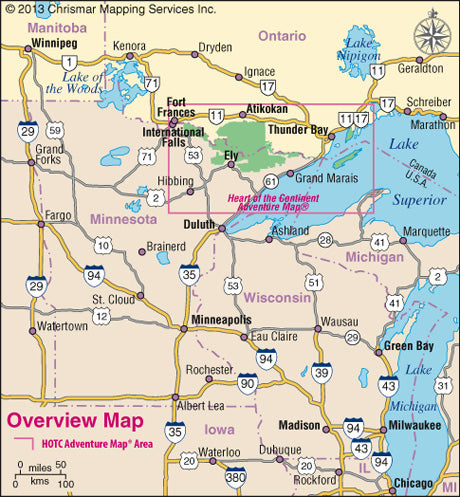
Check out the simple map showing the area covered by our guide. And if you decide to visit Quetico for its superb backcountry paddling, or even frontcountry campground, then you'll want our much more detailed Quetico Provincial Park guide, the official map of that Park.