• Welcome to our site • FREE SHIPPING in Canada for 2-3+ maps under total package weight of 500 grams • IMPORTANT NEWS: As you may be aware, the United States under U.S. Executive Order 14324, has suspended its duty-free de minimis (“disregard of trivial matters”) threshold of US$800 for all countries, including Canada. This order means that, starting August 29, 2025, all shipments entering the U.S. by post, courier, freight provider, or any commercial channel will be subject to an ad valorem (“according to value”) duty that must be prepaid before crossing the border. This duty will be equal to the effective tariff rate applicable to the product's country of origin (Canada in our case) under the International Emergency Economic Powers Act (IEEPA), a newly enacted old U.S. federal law. For Canada, the recently-assigned IEEPA rate is 35% for most goods. Unfortunately due to the onerous duties, declarations and paperwork involved required by this Executive order we will no longer be offering our products to either individual and business customers (only) in the United States. President Trump has repeatedly claimed that the Canada has “nothing” the USA needs. However, if you still wish to visit Canada for outdoor activities involving wilderness areas covered by our Adventure Map® series, we encourage you to seek out and purchase from a Canadian retailer after you cross the border. There is a list of such outlets on our website’s Where to Buy page. Call them in advance to ensure a copy is held for you to pick-up. And feel free to contact us if you have questions about the areas, maps or procedures • Best wishes •

Halfway Lake Provincial Park (AM0818)
  • Load image into Gallery viewer, Halfway Lake Provincial Park (AM0818)
  • Load image into Gallery viewer, Halfway Lake Provincial Park (AM0818)

Halfway Lake Provincial Park (AM0818)

Regular price
$8.95
Sale price
$8.95
Regular price
Sold out
Unit price
per 
Shipping calculated at checkout.

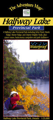
Our#: AM0818, ISBN: 0-929140-81-8, Scale: 1:25,000. Waterproof.

This compact but feature-rich provincial park sits on the Canadian Shield about an hour north of Sudbury. Easily accessible by highway about 60 kilometres north of Sudbury, it has a fine combination of really great hiking trails, and an excellent, but surprisingly little-used, backcountry canoe route.

The simple map below provides an overview to the region. The main access point is on the west side of the highway leading to a very well-appointed 215-site campground on the picturesque north shore of Halfway Lake. Another access point further up the highway is dedicated to the Osprey Heights Trail. It is one of 4 excellent hiking trails between 2 and 15km-long, each with exceptional viewpoints.

The backcountry canoe route heads south from the Campground through a series of pretty lakes, then north up the west side of the park - it's quite isolated and quiet with large cliffs bordering the route (at the top end you can wave to anybody way above you on the Hawk Ridge Trail viewpoint). Alternatively, Halfway and Bailey lake (separated by just a 310-metre portage) are plenty big-enough for a sea kayaking excursion.

Our 1:25,000 large-scale topographic map is extraordinarily detailed, showing the campground, all trails, lakes, streams, wetlands, open areas and much more. The back side is filled with informative text and colour photographs about the natural and human history of the area, trail and canoe route descriptions, safety tips, contact info, and more. It's just about everything you need to know when planning and then taking your trip.