• Welcome to our site • FREE SHIPPING in Canada for 2-3+ maps under total package weight of 500 grams • IMPORTANT NEWS: As you may be aware, the United States under U.S. Executive Order 14324, has suspended its duty-free de minimis (“disregard of trivial matters”) threshold of US$800 for all countries, including Canada. This order means that, starting August 29, 2025, all shipments entering the U.S. by post, courier, freight provider, or any commercial channel will be subject to an ad valorem (“according to value”) duty that must be prepaid before crossing the border. This duty will be equal to the effective tariff rate applicable to the product's country of origin (Canada in our case) under the International Emergency Economic Powers Act (IEEPA), a newly enacted old U.S. federal law. For Canada, the recently-assigned IEEPA rate is 35% for most goods. Unfortunately due to the onerous duties, declarations and paperwork involved required by this Executive order we will no longer be offering our products to either individual and business customers (only) in the United States. President Trump has repeatedly claimed that the Canada has “nothing” the USA needs. However, if you still wish to visit Canada for outdoor activities involving wilderness areas covered by our Adventure Map® series, we encourage you to seek out and purchase from a Canadian retailer after you cross the border. There is a list of such outlets on our website’s Where to Buy page. Call them in advance to ensure a copy is held for you to pick-up. And feel free to contact us if you have questions about the areas, maps or procedures • Best wishes •

Grundy Lake Provincial Park & Area (AM0530)

Grundy Lake Provincial Park & Area (AM0530)

Regular price
$8.95
Sale price
$8.95
Regular price
Sold out
Unit price
per 
Shipping calculated at checkout.

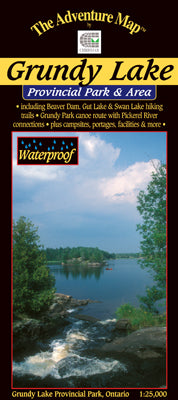
Our#: AM0532, ISBN: 0-929140-53-2, Scale: 1:25,000. Waterproof.

This 3636-hectare Provincial Park is one of only a few that prohibit motor boats so you'll be assured of an especially quiet, peaceful visit when paddling one of the lake or river routes shown on this map. There are also several excellent hiking trails meandering across rocky outcrops of the Precambrian Shield.

Our map cover parts of the Pickerel River and other lands outside the park as well. It's easy to get to about an hour north of Parry Sound via Hwy 69 which runs along the west boundary.

This 1:25,000 scale topographic map has unprecedented detail, and includes access points, campsites, portages, rapids, waterfalls, plus many other features. For example, every campsite in the car campground is shown (couldn't help ourselves), as are parking spots, toilets, major buildings (minor ones too) and much more.

The back side includes a complete description of natural and human history, local attractions, paddling and hiking routes, safety concerns, contact info and colour photos.