• Welcome to our site • FREE SHIPPING in Canada for 2-3+ maps under total package weight of 500 grams • IMPORTANT NEWS: As you may be aware, the United States under U.S. Executive Order 14324, has suspended its duty-free de minimis (“disregard of trivial matters”) threshold of US$800 for all countries, including Canada. This order means that, starting August 29, 2025, all shipments entering the U.S. by post, courier, freight provider, or any commercial channel will be subject to an ad valorem (“according to value”) duty that must be prepaid before crossing the border. This duty will be equal to the effective tariff rate applicable to the product's country of origin (Canada in our case) under the International Emergency Economic Powers Act (IEEPA), a newly enacted old U.S. federal law. For Canada, the recently-assigned IEEPA rate is 35% for most goods. Unfortunately due to the onerous duties, declarations and paperwork involved required by this Executive order we will no longer be offering our products to either individual and business customers (only) in the United States. President Trump has repeatedly claimed that the Canada has “nothing” the USA needs. However, if you still wish to visit Canada for outdoor activities involving wilderness areas covered by our Adventure Map® series, we encourage you to seek out and purchase from a Canadian retailer after you cross the border. There is a list of such outlets on our website’s Where to Buy page. Call them in advance to ensure a copy is held for you to pick-up. And feel free to contact us if you have questions about the areas, maps or procedures • Best wishes •

Algonquin 4 - North Central/Petawawa River (AM0168)
Reverse Side of our Algonquin 4 map
Algonquin Area Map Locator Guide
  • Load image into Gallery viewer, Algonquin 4 - North Central/Petawawa River (AM0168)
  • Load image into Gallery viewer, Algonquin 4 - North Central/Petawawa River (AM0168)
  • Load image into Gallery viewer, Reverse Side of our Algonquin 4 map
  • Load image into Gallery viewer, Algonquin Area Map Locator Guide

Algonquin 4 - North Central/Petawawa River (AM0168)

Regular price
$16.95
Sale price
$16.95
Regular price
Sold out
Unit price
per 
Shipping calculated at checkout.

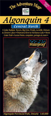
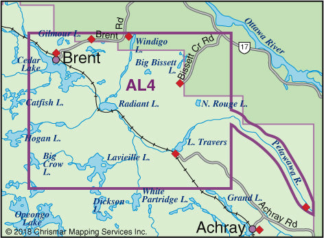
The fourth in our main Algonquin series, this map covers the area from beyond the park boundary in the north all the way south to Dickson Lake, and from Cedar Lake, PLUS we've added the Petawawa River beyond that all the way to McManus Lake at the east boundary of the Park.

Aside from the Petawawa River between Cedar Lake and McManus Lake, there are few major Algonquin routes entirely on this map, however it is essential to some superb longer routes that start and end just beyond its borders on our adjacent AL1, AL2 and Barron/Achray maps). Even so, there are 6 access points on this map including several of the most remote in the park, which leads to routes where you're less likely to encounter other paddlers - in the true wilderness parts of Algonquin.

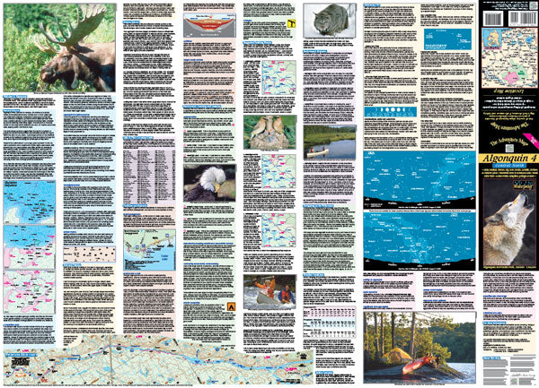
One of many attractions covered in some detail on the reverse side of this map is the Brent Crater - the largest of its kind in the world. Plus we have a special blurb on Algonquin's wolves, which are different from the typical wolf in Ontario.

As usual, this 1:60,000 scale map provides extraordinary terrain and vegetation detail, this map features campsites, portages, access points, hiking trails, facilities like campgrounds, telephones, historic sites, rental ranger cabins and many more attractions. And like others in the series, it's updated regularly and is waterproof.

Our#: AM0168, ISBN: 0-929140-16-8, Scale: 1:60,000. Waterproof.

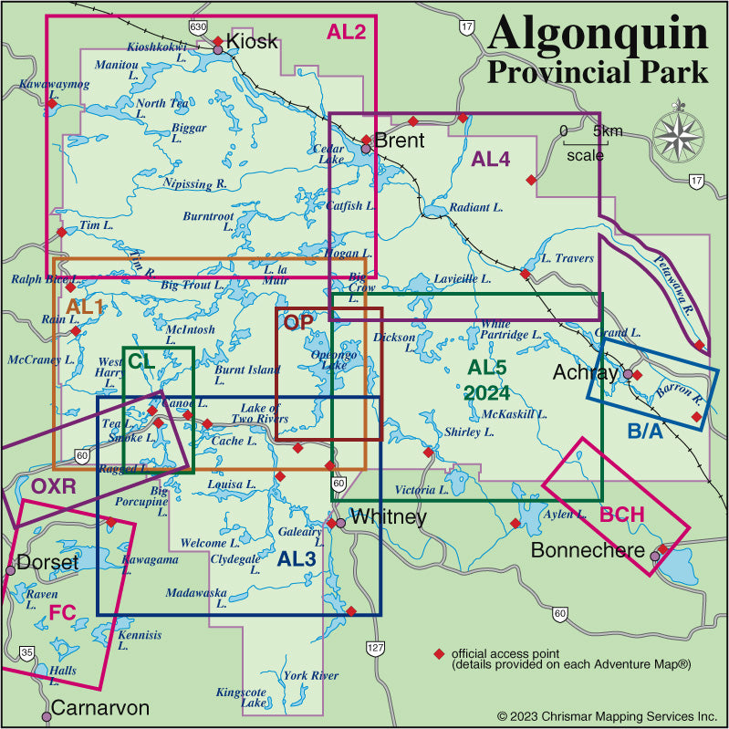
This map overlaps along its west edge our popular Algonquin 2 - Northwest map, in its southwest corner both our Algonquin 1 - Corridor North and our Opeongo Lake Close-up map guides, and to the south our soon to be completed Algonquin 5 - Central South map. There is also Algonquin 3-Corridor South in the series.

Not sure which of our Algonquin Area maps you want? Try our Algonquin Area Map Locator Guide - it's one of the images you can select on this page. And we've also included a simple close-up of the map area covered.