• Welcome to our site • FREE SHIPPING in Canada for 2-3+ maps under total package weight of 500 grams • IMPORTANT NEWS: As you may be aware, the United States under U.S. Executive Order 14324, has suspended its duty-free de minimis (“disregard of trivial matters”) threshold of US$800 for all countries, including Canada. This order means that, starting August 29, 2025, all shipments entering the U.S. by post, courier, freight provider, or any commercial channel will be subject to an ad valorem (“according to value”) duty that must be prepaid before crossing the border. This duty will be equal to the effective tariff rate applicable to the product's country of origin (Canada in our case) under the International Emergency Economic Powers Act (IEEPA), a newly enacted old U.S. federal law. For Canada, the recently-assigned IEEPA rate is 35% for most goods. Unfortunately due to the onerous duties, declarations and paperwork involved required by this Executive order we will no longer be offering our products to either individual and business customers (only) in the United States. President Trump has repeatedly claimed that the Canada has “nothing” the USA needs. However, if you still wish to visit Canada for outdoor activities involving wilderness areas covered by our Adventure Map® series, we encourage you to seek out and purchase from a Canadian retailer after you cross the border. There is a list of such outlets on our website’s Where to Buy page. Call them in advance to ensure a copy is held for you to pick-up. And feel free to contact us if you have questions about the areas, maps or procedures • Best wishes •

Algonquin 1-Corridor North Cover
Algonquin 1 - Corridor North (AM0133)
Algonquin Area Map Locator Guide
  • Load image into Gallery viewer, Algonquin 1-Corridor North Cover
  • Load image into Gallery viewer, Algonquin 1 - Corridor North (AM0133)
  • Load image into Gallery viewer, Algonquin Area Map Locator Guide

Algonquin 1 - Corridor North (AM0133)

Regular price
$16.95
Sale price
$16.95
Regular price
Sold out
Unit price
per 
Shipping calculated at checkout.

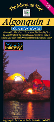
Our#: AM0133, ISBN: 0-929140-13-3, Scale: 1:60,000. Waterproof.

Our detailed topographic map & guide to all paddling routes, hiking & backpacking trails, and attractions all along and well north of the Highway 60 corridor in Algonquin Provincial Park, Ontario. It covers the area from Opeongo Lake and the Visitor Centre in the east, to the Park boundary in the west, and from the Tim River and Lake La Muir in the north, to Ragged Lake and Whitefish Lake in the south.

In addition to extraordinary terrain and vegetation detail, this map features campsite, portages, access points, hiking & backpacking trails, facilities like parking, campgrounds, telephones, historic sites and other attractions. And, as with all Adventure Maps®, the back side is covered with extensive text, colour photos, and graphics describing the area's natural history, human history, route suggestions, Park procedures, safety tips, contact info and much more. Of course, we update it regularly, and it is completely waterproof (in a pinch you can use it as rain hat!)

_____

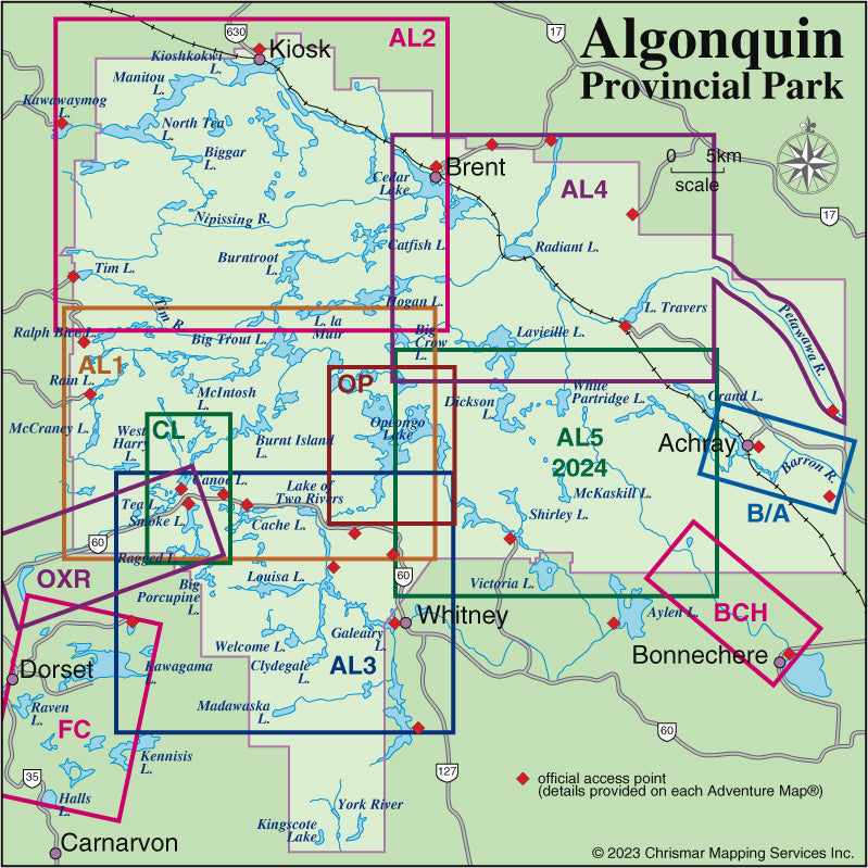
Overlaps with Algonquin 2 - Northwest, Algonquin 3 - Corridor South, and Algonquin 4 - North Central. Also consider our smaller-size but larger-scale close-up map guides to popular sections of Algonquin Park - Canoe Lake & Area, Opeongo Lake & Area, Oxtongue River & Ragged Falls, Barron-Achray Area and Bonnechere River.

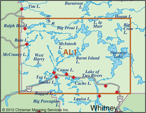
Not sure which of our Algonquin Area maps you want? Try our Algonquin Area Map Locator Guide - it's one of the images you can select on this page. And we've also included a simple close-up of the map area covered.