

Our#: AM0206, ISBN: 0-929140-20-6, Scale: 1:30,000. Waterproof.
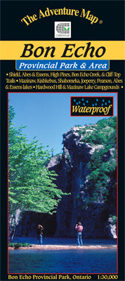
One of eastern Ontario's major provincial parks, this perennial favourite has something for everyone, including five great hiking trails, one of which climbs nearly 100 metres up the face of Mazinaw Rock to an impressive lookout over the lake. The Abes and Essens Backpacking Trail loops around several lakes through rugged Shield Country. Rockclimbing is possible with an approved permit.
Or consider the many boating opportunities, from large Mazinaw Lake to the canoe camping lakes on the west edge of the Park to one of several other canoe or kayaking routes in and outside the park. Pringle Lake, Little Marble, and parts of Skootamatta Lake, Marble and Mississagagon Lake are included on this map.
This Park also has some fascinating human history of a literary and artistic flavour (Walt Whitman, Merrill Denison and especially his first wife Muriel who had a connection with the child actress Shirley Temple, The Group of Seven, etc.), and an excellent Park Store, in Greystones, a lovely old stone building. If paddling check out the pictographs along the waterline at the base of the Rock.
Details are also provided of the several campgrounds, access points, facilities, and other attractions. All on the typical waterproof topographic map with a back side full of helpful info about the park history, animals, fish and birds, hiking trails, canoe routes, other attractions, and much more.