• Welcome to our site • Please NOTE THAT WE WILL BE UNABLE TO FILL OR SHIP ORDERS between Monday September 1st and Wednesday September 17th. So if you wish to order feel free to do so recognising that we cannot ship until the 18th. Alternatively, check our STORES page for retailers carrying our maps and purchase from them • • FREE SHIPPING in Canada for 2-3+ maps under total package weight of 500 grams • • IMPORTANT NEWS: As you may be aware, the United States under U.S. Executive Order 14324, has suspended its duty-free de minimis (“disregard of trivial matters”) threshold of US$800 for all countries, including Canada. This order APPARENTLY means that, starting August 29, 2025, all shipments entering the U.S. by post, courier, freight provider, or any commercial channel will be subject to an ad valorem (“according to value”) duty that must be PREPAID BY THE SENDER before crossing the border. For Canada this duty will be 35% per the International Emergency Economic Powers Act (IEEPA), a newly enacted old U.S. federal law. Unfortunately, due to the onerous rate, declarations and paperwork required by this Executive order we will no longer be offering our products to individuals and business customers in (only) the United States. However, if you still wish to visit Canada for outdoor activities involving wilderness areas covered by our Adventure Map® series, we encourage you to seek out and purchase from a Canadian retailer AFTER you cross the border. There is a list of such outlets on our website’s STORES page. Call them in advance to ensure a copy is held for you to pick-up. And feel free to contact us if you have questions about the areas, maps or procedures • Best wishes •

La Mauricie National Park of Canada (AM0699e)

La Mauricie National Park of Canada (AM0699e)

Regular price
$14.95
Sale price
$14.95
Regular price
Sold out
Unit price
per 
Shipping calculated at checkout.

Our#: AM0699e, ISBN: 0-929140-69-9e, Scale: 1:50,000. Waterproof.

Aussie disponible en français: Parc national de la Mauricie
Notre # AM0699f, ISBN : 0-929140-69-9f, Échelle : 1:50,000. Imperméable.

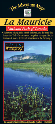
This superb National Park is located in the Laurentians north of Trois-Rivieres in Quebec, and it's a toss-up whether it makes a better hiking or paddling destination.

There are over 150 kilometres of hiking and backpacking trails, from short level walks to the rugged and challenging 75 km long Laurentian Trail. There are also about 200 lakes and rivers in the park that make for excellent canoe camping possibilities. And just about the best fall colours we've ever seen!

Our 1:50,000 scale map took two years to create, much of that time spent surveying the hiking trails, canoe routes and other attractions (it's a tough life...). This large sheet (24x28") is waterproof, has 15m contours, and is covered with features including natural and human history, trail and canoe route descriptions, enlargement maps of key activity areas, great colour photographs - in short just about everything you'd want to help you plan and enjoy your trip.

As with many other maps in the series, we're pleased to say that this one was adopted by the Park as their official map.