• Welcome to our site • Please NOTE THAT WE WILL BE UNABLE TO FILL OR SHIP ORDERS between Monday September 1st and Wednesday September 17th. So if you wish to order feel free to do so recognising that we cannot ship until the 18th. Alternatively, check our STORES page for retailers carrying our maps and purchase from them • • FREE SHIPPING in Canada for 2-3+ maps under total package weight of 500 grams • • IMPORTANT NEWS: As you may be aware, the United States under U.S. Executive Order 14324, has suspended its duty-free de minimis (“disregard of trivial matters”) threshold of US$800 for all countries, including Canada. This order APPARENTLY means that, starting August 29, 2025, all shipments entering the U.S. by post, courier, freight provider, or any commercial channel will be subject to an ad valorem (“according to value”) duty that must be PREPAID BY THE SENDER before crossing the border. For Canada this duty will be 35% per the International Emergency Economic Powers Act (IEEPA), a newly enacted old U.S. federal law. Unfortunately, due to the onerous rate, declarations and paperwork required by this Executive order we will no longer be offering our products to individuals and business customers in (only) the United States. However, if you still wish to visit Canada for outdoor activities involving wilderness areas covered by our Adventure Map® series, we encourage you to seek out and purchase from a Canadian retailer AFTER you cross the border. There is a list of such outlets on our website’s STORES page. Call them in advance to ensure a copy is held for you to pick-up. And feel free to contact us if you have questions about the areas, maps or procedures • Best wishes •

Glacier National Park - Winter (AM0435)

Glacier National Park - Winter (AM0435)

Regular price
$15.95
Sale price
$15.95
Regular price
Sold out
Unit price
per 
Shipping calculated at checkout.

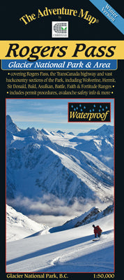
Our#: AM0435, ISBN: 0-929140-43-5, Scale: 1:50,000. Waterproof.

For years you've been enjoying Rogers Pass area hiking and backpacking trips using our classic Rogers Pass - Summer Version map guide. Well, there is now a companion Winter Version to keep you company in the outdoors and it covers a much larger area - almost the entire Park.

This great big beautiful map guide is targetted at skiers, snowboarders and snowshoers visiting one of the world's great destinations for backcountry alpine adventure. Special features include all the Winter Permit Areas, permitted parking areas, Trans Canada Highway no-stopping zones, popular run and route locations, lots of info about avalanche safety, and a bunch of pretty cool and inspirational photos. All combined with a superb 1:50,000 scale 25-metre topographic map.

–––––

But don't forget our new Rogers Pass - Summer Version map guide of this world-class (really) alpine hiking and backpacking destination.

Also consider our map of Mount Revelstoke National Park, which is just a few kilometres west of Rogers Pass, and also has an abundance of hiking and biking trails, plus plenty of incredible scenery.