• Welcome to our site • FREE SHIPPING in Canada for 2-3+ maps under total package weight of 500 grams • IMPORTANT NEWS: As you may be aware, the United States under U.S. Executive Order 14324, has suspended its duty-free de minimis (“disregard of trivial matters”) threshold of US$800 for all countries, including Canada. This order means that, starting August 29, 2025, all shipments entering the U.S. by post, courier, freight provider, or any commercial channel will be subject to an ad valorem (“according to value”) duty that must be prepaid before crossing the border. This duty will be equal to the effective tariff rate applicable to the product's country of origin (Canada in our case) under the International Emergency Economic Powers Act (IEEPA), a newly enacted old U.S. federal law. For Canada, the recently-assigned IEEPA rate is 35% for most goods. Unfortunately due to the onerous duties, declarations and paperwork involved required by this Executive order we will no longer be offering our products to either individual and business customers (only) in the United States. President Trump has repeatedly claimed that the Canada has “nothing” the USA needs. However, if you still wish to visit Canada for outdoor activities involving wilderness areas covered by our Adventure Map® series, we encourage you to seek out and purchase from a Canadian retailer after you cross the border. There is a list of such outlets on our website’s Where to Buy page. Call them in advance to ensure a copy is held for you to pick-up. And feel free to contact us if you have questions about the areas, maps or procedures • Best wishes •

Esker Lake Provincial Park (AM0826)

Esker Lake Provincial Park (AM0826)

Regular price
$8.95
Sale price
$8.95
Regular price
Sold out
Unit price
per 
Shipping calculated at checkout.

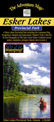
Our#: AM0826, ISBN: 0-929140-82-6, Scale: 1:20,000. Waterproof.

This little-known park situated in the sandy forests near Kirkland Lake, Ontario is almost never crowded, so if you're looking for a quiet place to hike on trails up to 20 kilometres in length, or paddle on numerous wilderness lakes separated by short portages (longest 300 metres!), then this the place for you.

Our large-scale 1:20,000 scale topographic map shows trails, lakes, streams, wetlands, open areas, extraordinary contour detail and much more.

And the back side is filled with informative text and colour photographs about the natural and human history of the area, trail descriptions, canoe routes, safety tips, contact info, and more. This map was adopted as the official map of the Park.