• Welcome to our site • FREE SHIPPING in Canada for 2-3+ maps under total package weight of 500 grams • IMPORTANT NEWS: As you may be aware, the United States under U.S. Executive Order 14324, has suspended its duty-free de minimis (“disregard of trivial matters”) threshold of US$800 for all countries, including Canada. This order means that, starting August 29, 2025, all shipments entering the U.S. by post, courier, freight provider, or any commercial channel will be subject to an ad valorem (“according to value”) duty that must be prepaid before crossing the border. This duty will be equal to the effective tariff rate applicable to the product's country of origin (Canada in our case) under the International Emergency Economic Powers Act (IEEPA), a newly enacted old U.S. federal law. For Canada, the recently-assigned IEEPA rate is 35% for most goods. Unfortunately due to the onerous duties, declarations and paperwork involved required by this Executive order we will no longer be offering our products to either individual and business customers (only) in the United States. President Trump has repeatedly claimed that the Canada has “nothing” the USA needs. However, if you still wish to visit Canada for outdoor activities involving wilderness areas covered by our Adventure Map® series, we encourage you to seek out and purchase from a Canadian retailer after you cross the border. There is a list of such outlets on our website’s Where to Buy page. Call them in advance to ensure a copy is held for you to pick-up. And feel free to contact us if you have questions about the areas, maps or procedures • Best wishes •

Arrowhead Provincial Park (AM0834)

Arrowhead Provincial Park (AM0834)

Regular price
$8.95
Sale price
$8.95
Regular price
Sold out
Unit price
per 
Shipping calculated at checkout.

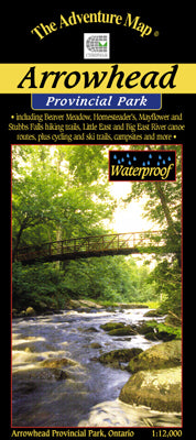
Our#: AM0834, ISBN: 0-929140-83-4, Scale: 1:12,000. Waterproof.

Located just north of Huntsville on Hwy 11, this smallish provincial park is certainly chock full of great outdoor adventure options. There are several great hiking trails through rocky Canadian Shield country, with fine lookouts and wildlife viewing opportunities. Or you might prefer canoeing or kayaking on one of several lakes in the park or the meandering Big East River along the south edge of this map. There are also several fully-serviced campgrounds to choose from including motor-home pull-throughs and yurts.

And don't forget the winter season, for Arrowhead has some really excellent ski trails, including a  ski-skating loop.

Our large-scale 1:12,000 topographic map shows all trails, lakes, streams, wetlands, open areas, extraordinary contour detail and even individual campsites.

And the back side, as usual is filled with informative text and colour photographs about the natural and human history of the area, trail descriptions, canoe routes, safety tips, contact info, and more.