• Welcome to our site • FREE SHIPPING in Canada for 2-3+ maps under total package weight of 500 grams • IMPORTANT NEWS: As you may be aware, the United States under U.S. Executive Order 14324, has suspended its duty-free de minimis (“disregard of trivial matters”) threshold of US$800 for all countries, including Canada. This order APPARENTLY means that, starting August 29, 2025, all shipments entering the U.S. by post, courier, freight provider, or any commercial channel will be subject to an ad valorem (“according to value”) duty that must be PREPAID BY THE SENDER before crossing the border. This duty will be equal to the effective tariff rate applicable to the product's country of origin (Canada in our case) under the International Emergency Economic Powers Act (IEEPA), a newly enacted old U.S. federal law. For Canada, the recently-assigned IEEPA rate is 35% for most goods. Unfortunately due to the onerous duties, declarations and paperwork required by this Executive order we will likely no longer be offering our products to individuals (possibly except by letter-mail) and business customers in (only) the United States. President Trump has repeatedly claimed that the Canada has “nothing” the USA needs. However, if you still wish to visit Canada for outdoor activities involving wilderness areas covered by our Adventure Map® series, we encourage you to seek out and purchase from a Canadian retailer after you cross the border. There is a list of such outlets on our website’s Where to Buy page. Call them in advance to ensure a copy is held for you to pick-up. And feel free to contact us if you have questions about the areas, maps or procedures • Best wishes •

Poker Lake Area - Haliburton Highlands (AM0613)

Poker Lake Area - Haliburton Highlands (AM0613)

Regular price
$6.95
Sale price
$6.95
Regular price
Sold out
Unit price
per 
Shipping calculated at checkout.

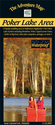
Our#: AM0613, ISBN: 0-929140-61-3, Scale: 1:15,000. Waterproof.

The Poker Lake System is a compact paddling area on crown land just west of Carnarvon in Haliburton County. The area straddles Hwy 118, with a short-portage network of smaller lakes on the north side and the large multi-bayed Big East Lake on the south side. It's perfect for family canoeing, day paddles and 2-3 night trips.

Our detailed 1:15,000 large-scale topographic map covers the entire paddling area and a little beyond. As usual, the map highlights access points, portages, campsites, rapids and other important features, as well as text and photos on the back side providing local history, route descriptions, safety issues, contact and other information to help you plan and take your trip.

Following Chrismar's popularization of this area over 20 years ago due to our first edition, the local municipality has now implemented a revenue-capturing user-pay system for overnight visits (day-use is free).

Our most recent version includes campsite numbers, day-use and group sites, camper and tent limits by site, and other useful information about recent developments.

–––––

Also check out the nearby Frost Centre area, another cottage country canoe route system "put on the map" by Chrismar over 20 years ago.