


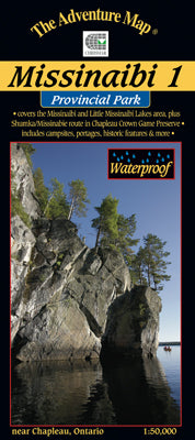

Our#: AM0915, ISBN: 0-929140-91-5, Scale: 1:50,000. Waterproof.
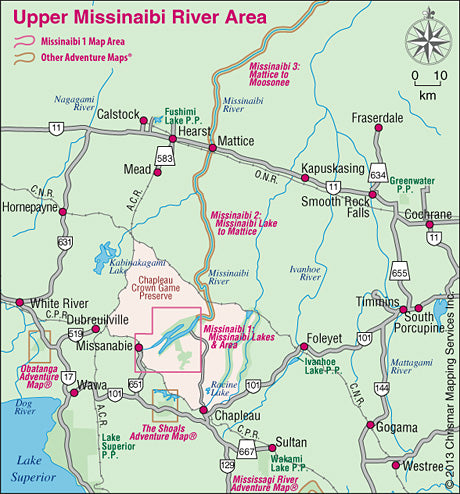
Most serious paddlers have heard of the Missinaibi River - the longest unbroken stretch of paddling river in Ontario - but that's not what this map is about. This one is about the lakes and headwaters that become the river at the northeast tip of this sheet, and in many ways this area is just as great.
There are two major lakes on this map - Missinaibi Lake and Little Missinaibi Lake. The former has main arms over 43 kilometres long with numerous bays and islands, superb fishing, great cliffs and some of the continents finest examples of aboriginal pictographs. There is plenty of lake here for several weeks of superb canoe or, even better, sea kayak paddling.
Little Missinaibi Lake is quite different than her bigger relative - narrow and convoluted like a pretzel - but with equally fascinating cliffs, old-growth trees and pictograph sites. A very challenging whitewater river joins the two, with an alternative flatwater route with portages preferred by most.
But that's not all this are has to offer. There is also a small, but nicely situated, campground on Missinaibi Lake, at the end of the access road from Chapleau. We've also included a lot of fine paddling area outside the Park, in particular the Shumka area (see NOTE below) that makes a great wild paddling loop from "big and little Miss" south and west to the railway and back. The railway is key because it means you can access the area from as far away as Sudbury. No need to drive - just throw your canoe and gear on the train and get off and on where you want.
But the drive is also worthwhile because this entire map is smack dab in the middle of the Chapleau Crown Game Preserve - the largest of its kind in the world. Wildlife is not hunted or trapped here so you're likely to see more than usual - big moose, bald eagles, osprey, black bear, and more.
This waterproof, 1:50,000 scale, completely original (like all our others) topographic map has unprecedented detail, and includes backcountry campsites, portages, access points, points of historical interest, plus many other features such as a campground map enlargement and a special section on pictgraphs.
The map measures 26x32.5", has a contour interval of 10 metres, and includes text and photos about natural and human history, canoe route descriptions, safety tips, contact info, great colour photographs - in short just about everything you'd want to help you plan and enjoy your trip.
NOTE: if you're planning to paddle the Shumka area please note that there is now a logging road that can be used for access from a different train drop-off point along the railway. See the updated map section below for details. They will be included on our next printing of the Missinaibi 1 map.
Note: If you're planning on paddling the entire Missinaibi River you'll also need our Missinaibi 2-Missinaibi Lake to Mattice and Missinaibi 3-Mattice to Moosonee. It's a long river!