• Welcome to our site • FREE SHIPPING in Canada for 2-3+ maps under total package weight of 500 grams • IMPORTANT NEWS: As you may be aware, the United States under U.S. Executive Order 14324, has suspended its duty-free de minimis (“disregard of trivial matters”) threshold of US$800 for all countries, including Canada. This order APPARENTLY means that, starting August 29, 2025, all shipments entering the U.S. by post, courier, freight provider, or any commercial channel will be subject to an ad valorem (“according to value”) duty that must be PREPAID BY THE SENDER before crossing the border. This duty will be equal to the effective tariff rate applicable to the product's country of origin (Canada in our case) under the International Emergency Economic Powers Act (IEEPA), a newly enacted old U.S. federal law. For Canada, the recently-assigned IEEPA rate is 35% for most goods. Unfortunately due to the onerous duties, declarations and paperwork required by this Executive order we will likely no longer be offering our products to individuals (possibly except by letter-mail) and business customers in (only) the United States. President Trump has repeatedly claimed that the Canada has “nothing” the USA needs. However, if you still wish to visit Canada for outdoor activities involving wilderness areas covered by our Adventure Map® series, we encourage you to seek out and purchase from a Canadian retailer after you cross the border. There is a list of such outlets on our website’s Where to Buy page. Call them in advance to ensure a copy is held for you to pick-up. And feel free to contact us if you have questions about the areas, maps or procedures • Best wishes •

Algonquin - Opeongo Lake Close-up (AM0559)
Algonquin Area Map Locator Guide
  • Load image into Gallery viewer, Algonquin - Opeongo Lake Close-up (AM0559)
  • Load image into Gallery viewer, Algonquin Area Map Locator Guide

Algonquin - Opeongo Lake Close-up (AM0559)

Regular price
$9.95
Sale price
$9.95
Regular price
Sold out
Unit price
per 
Shipping calculated at checkout.

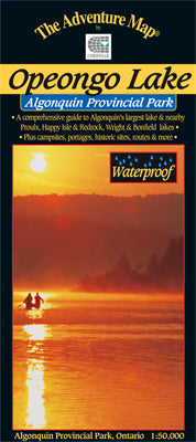
Our#: AM0559, ISBN: 0-929140-55-9, Scale: 1:50,000. Waterproof.

Opeongo is the largest lake in Algonquin Park, and plenty big enough for a week or more of canoe tripping. Other lakes on this 1:50,000 scale map include Happy Isle, Redrock, Proulx, Wright and Bonfield, as well as all the campsites, portages, facilities, fish species and other features you'd expect from one of our maps.

We've even indicated the routes of two of the first explorers through the area. The back side features colour photos and text about the area, including several recommended trips in the area.

_____

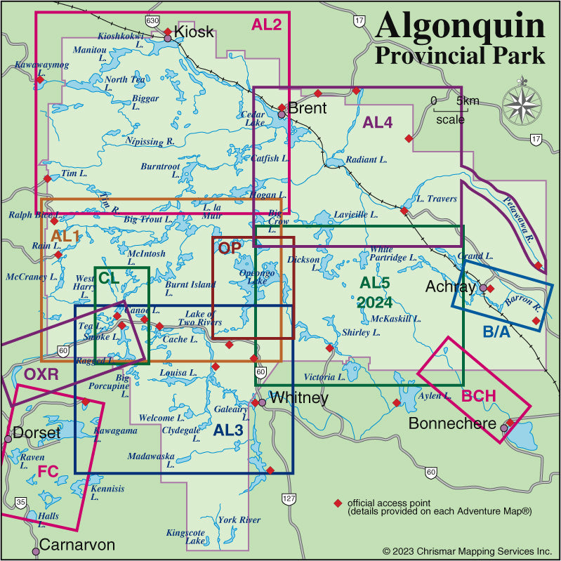
Also consider our other larger-scale Algonquin Close-up Maps of smaller popular areas (Bonnechere River, Canoe Lake, Oxtongue River and Barron-Achray) suitable for short trips of a week or less. Or try our larger area Algonquin guides (Algonquin 1-Corridor North, Algonquin 2-Northwest, Algonquin 3-Corridor South and Algonquin 4-Central North maps) suitable for longer trips or shorter ones in less-busy areas.

Not sure which of our Algonquin Area maps you want? Try our Algonquin Area Map Locator Guide - it's one of the images you can select on this page.