• Welcome to our site • FREE SHIPPING in Canada for 2-3+ maps under total package weight of 500 grams • IMPORTANT NEWS: As you may be aware, the United States under U.S. Executive Order 14324, has suspended its duty-free de minimis (“disregard of trivial matters”) threshold of US$800 for all countries, including Canada. This order APPARENTLY means that, starting August 29, 2025, all shipments entering the U.S. by post, courier, freight provider, or any commercial channel will be subject to an ad valorem (“according to value”) duty that must be PREPAID BY THE SENDER before crossing the border. This duty will be equal to the effective tariff rate applicable to the product's country of origin (Canada in our case) under the International Emergency Economic Powers Act (IEEPA), a newly enacted old U.S. federal law. For Canada, the recently-assigned IEEPA rate is 35% for most goods. Unfortunately due to the onerous duties, declarations and paperwork required by this Executive order we will likely no longer be offering our products to individuals (possibly except by letter-mail) and business customers in (only) the United States. President Trump has repeatedly claimed that the Canada has “nothing” the USA needs. However, if you still wish to visit Canada for outdoor activities involving wilderness areas covered by our Adventure Map® series, we encourage you to seek out and purchase from a Canadian retailer after you cross the border. There is a list of such outlets on our website’s Where to Buy page. Call them in advance to ensure a copy is held for you to pick-up. And feel free to contact us if you have questions about the areas, maps or procedures • Best wishes •

Algonquin - Canoe Lake/Tom Thomson Close-up (AM0540)
Algonquin Area Map Locator Guide
  • Load image into Gallery viewer, Algonquin - Canoe Lake/Tom Thomson Close-up (AM0540)
  • Load image into Gallery viewer, Algonquin Area Map Locator Guide

Algonquin - Canoe Lake/Tom Thomson Close-up (AM0540)

Regular price
$9.95
Sale price
$9.95
Regular price
Sold out
Unit price
per 
Shipping calculated at checkout.

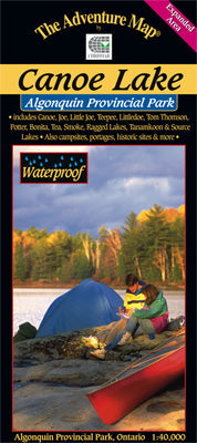
Our#: AM0559, ISBN: 0-929140-55-9, Scale: 1:50,000. Waterproof.

This popular 1:40,000 scale map covers the area from Ragged Lake in the south to all the way north to Tom Thomson Lake, and from Tea Lake in the west to Source and Tanamakoon lakes in the east, including the popular Canoe Lake and Smoke Lake access points. As such it's perfect for a short daytrip, a few days over the weekend or even a week travelling north to Tom Thomson.

The text and pictures on the reverse side describe the former logging boom town of Mowat, artist Tom Thomson and his mysterious death and local nursing legend Molly Colson, as well as hiking trails, park facilities and trip tips. Waterproof.

_____

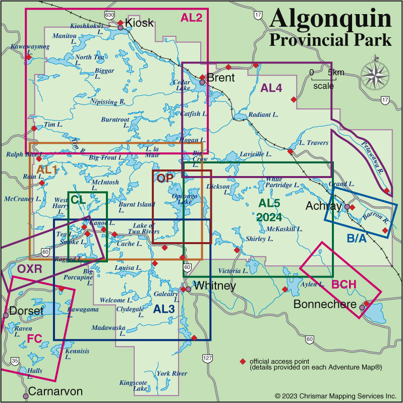
Also consider our other larger-scale Algonquin Close-up Maps of smaller popular areas (Bonnechere River, Oxtongue River and Barron-Achray) suitable for short trips of a week or less. Or try our larger area Algonquin guides (Algonquin 1-Corridor North, Algonquin 2-Northwest, Algonquin 3-Corridor South and Algonquin 4-Central North maps) suitable for longer trips or shorter ones in less-busy areas.

Not sure which of our Algonquin Area maps you want? Try our Algonquin Area Map Locator Guide - it's one of the images you can select on this page.