• Welcome to our site • Please NOTE THAT WE WILL BE UNABLE TO FILL OR SHIP ORDERS between Monday September 1st and Wednesday September 17th. So if you wish to order feel free to do so recognising that we cannot ship until the 18th. Alternatively, check our STORES page for retailers carrying our maps and purchase from them • • FREE SHIPPING in Canada for 2-3+ maps under total package weight of 500 grams • • IMPORTANT NEWS: As you may be aware, the United States under U.S. Executive Order 14324, has suspended its duty-free de minimis (“disregard of trivial matters”) threshold of US$800 for all countries, including Canada. This order APPARENTLY means that, starting August 29, 2025, all shipments entering the U.S. by post, courier, freight provider, or any commercial channel will be subject to an ad valorem (“according to value”) duty that must be PREPAID BY THE SENDER before crossing the border. For Canada this duty will be 35% per the International Emergency Economic Powers Act (IEEPA), a newly enacted old U.S. federal law. Unfortunately, due to the onerous rate, declarations and paperwork required by this Executive order we will no longer be offering our products to individuals and business customers in (only) the United States. However, if you still wish to visit Canada for outdoor activities involving wilderness areas covered by our Adventure Map® series, we encourage you to seek out and purchase from a Canadian retailer AFTER you cross the border. There is a list of such outlets on our website’s STORES page. Call them in advance to ensure a copy is held for you to pick-up. And feel free to contact us if you have questions about the areas, maps or procedures • Best wishes •

Franklin, Mink & McCoy Islands - Georgian Bay (AM0761)
Franklin Minks McCoys Location Map
  • Load image into Gallery viewer, Franklin, Mink & McCoy Islands - Georgian Bay (AM0761)
  • Load image into Gallery viewer, Franklin Minks McCoys Location Map

Franklin, Mink & McCoy Islands - Georgian Bay (AM0761)

Regular price
$13.95
Sale price
$13.95
Regular price
Sold out
Unit price
per 
Shipping calculated at checkout.

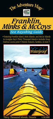
Our#: AM0761, ISBN: 0-929140-76-1, Scale: 1:30,000. Waterproof.

This is one of the most easily accessible, most popular sea kayaking area in all of the Great Lakes. And with thousands of islands dotting the east coast of Georgian Bay and into the Parry Sound it's easy to understand why. This map, which was the first of our series along the coast, includes Franklin Island & its numerous satellite islands near the coast, the Mink Islands further west and the McCoy Islands to the north of the Minks.

Aside from the extraordinarily beautiful rocky islands, the area has a rich boating, fishing and lighthouse keeping history, with its fair share of shipwrecks and seafaring stories. Much of this fascinating human history is detailed in text which covers the entire backside where you'll also find information and great colour photographs about the geologic and natural history of the area, plus useful sections about planning your trip, route suggestions, gear guide, backcountry etiquette, safety concerns, contact information and much more.

Our 1:30,000 scale map has extraordinary geographic detail plus special features showing shallow waters, shoals, buoys, ranges, lighthouses and other nautical items. It combines the most useful features of topographic maps and nautical charts, which is just what sea kayakers prefer and have been asking us for. There is even a compass rose.

On waterproof plastic as usual, so sea kayakers can get it as wet as they like without it disintegrating! It can even double as a useful rain hat.

–––––

If you're looking for an alternative sea kayaking area to visit consider our Philip Edward Island & Area map on the north shore of Georgian Bay. Also great for canoeing in fine weather.